// Dev Log - Galaxion Trade Empire
// Part 2 - Menus, Battle Grid, Galaxy Network Pathfinding
TLDR; This post covers the initial menus for planets, the start of a grid system for turn based battles, and the galaxy jump network with pathfinding.
> 2023-10-03
> working on research menu / system now
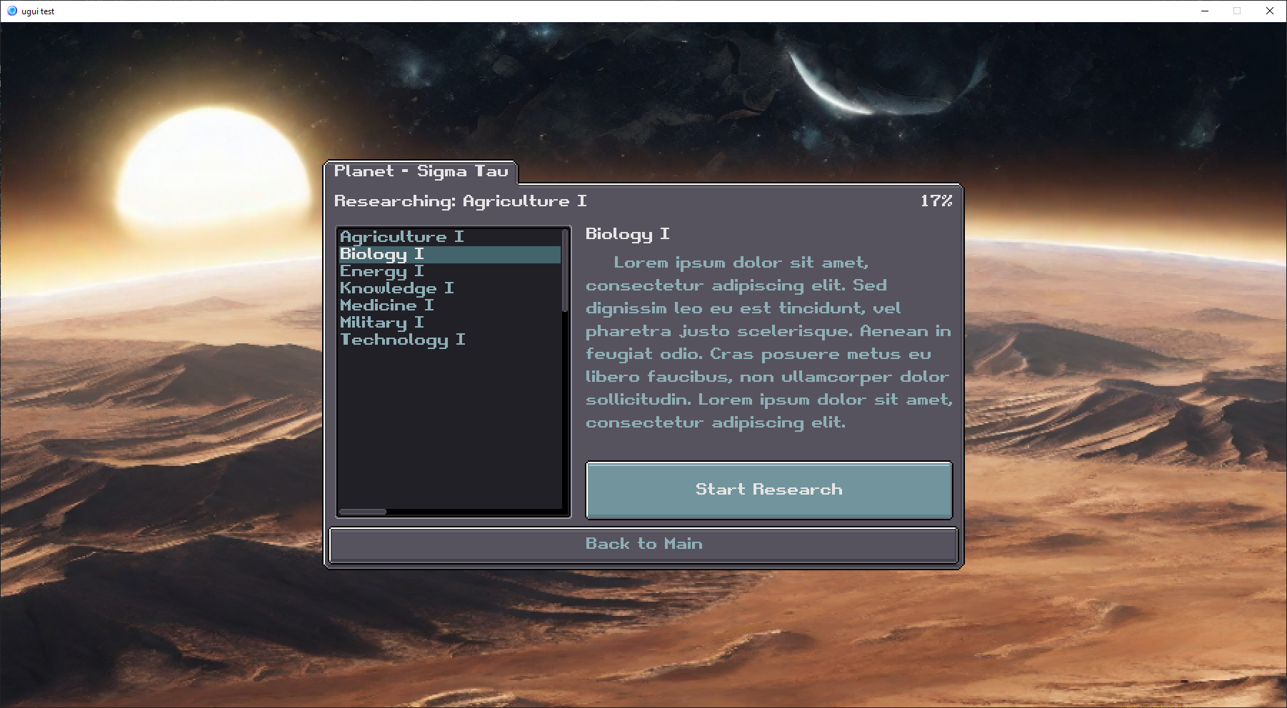
> the idea is that as you learn tech the list on the left will expand into a tree view, clicking on an item will show the description, and clicking the big start research button will commence the research. research speed is determined by previous research and how many scientists you have.
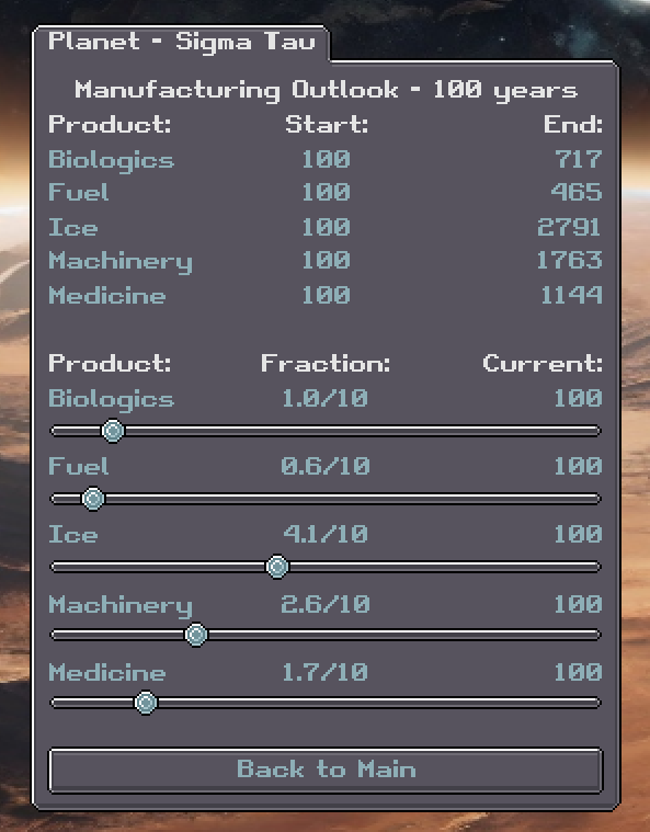
> got the manufacturing menu completely working now so that it updates the manufacturing outlook based on fraction and skill level with manufacturing each type of commodity
> making progress on ship cargo holds and hangar bays


> not fully operational yet, just laying up the menus
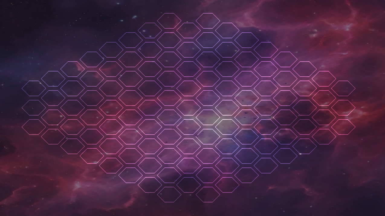
> testing out some gameboard sizing for tactical combat sequences
> 20 hours in so far on this project
> October 4, 2023
> paper prototyping hex combat gameplay, thinking about doing active time based battle system
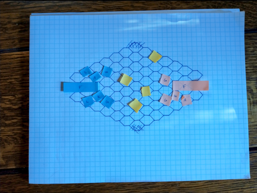
> paper prototyping hex combat gameplay, thinking about doing active time based battle system
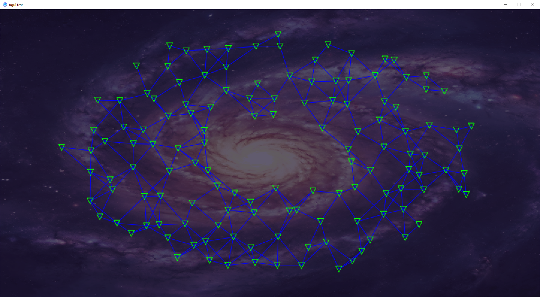
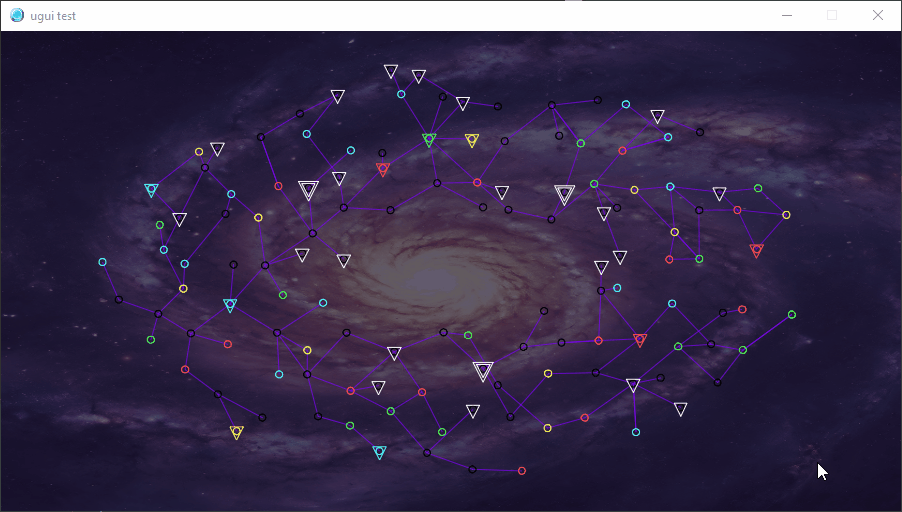
> just added in a random galaxy network system
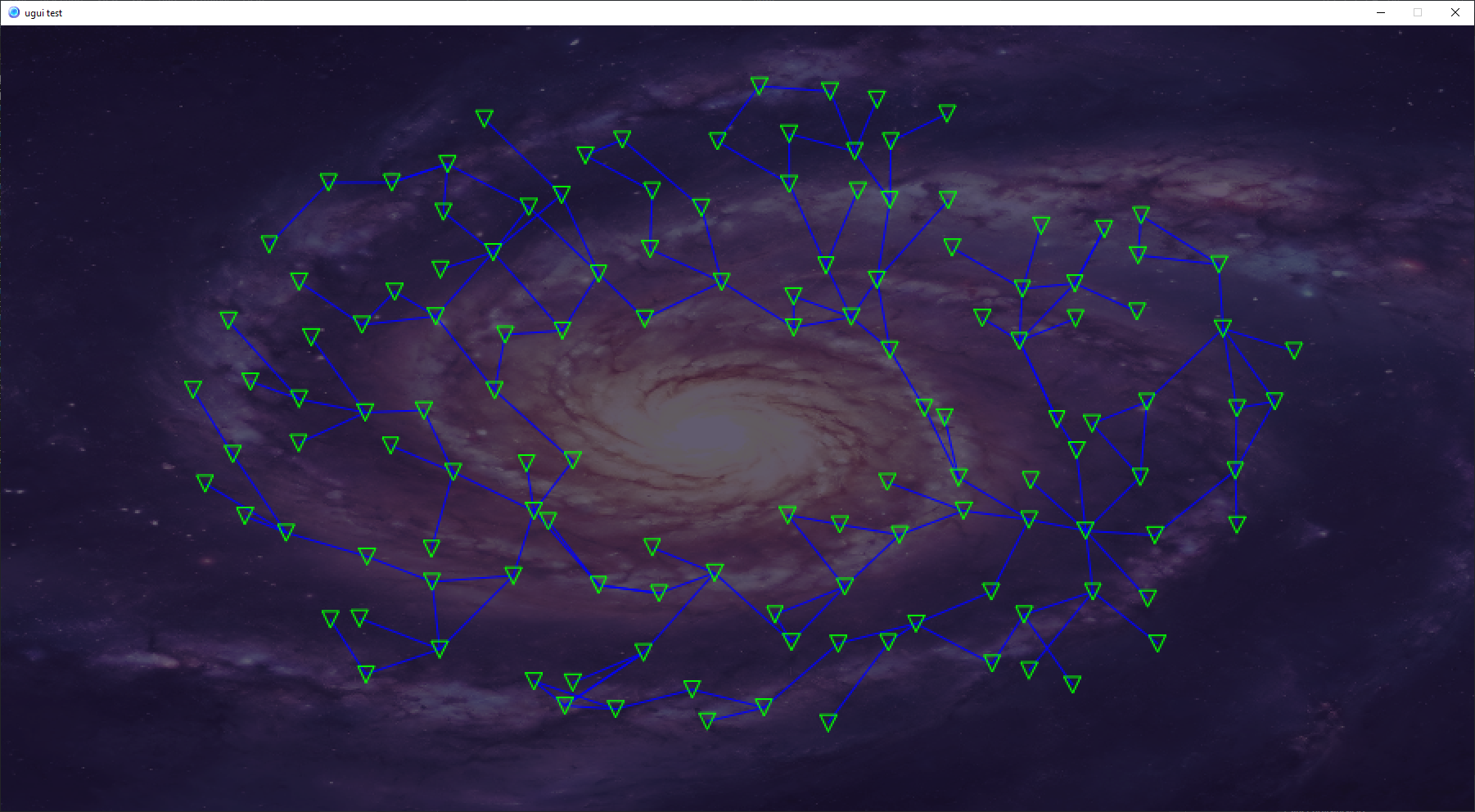
> it starts with a densely connected graph of randomly placed locations, then creates a minimum spanning tree with random links added back in
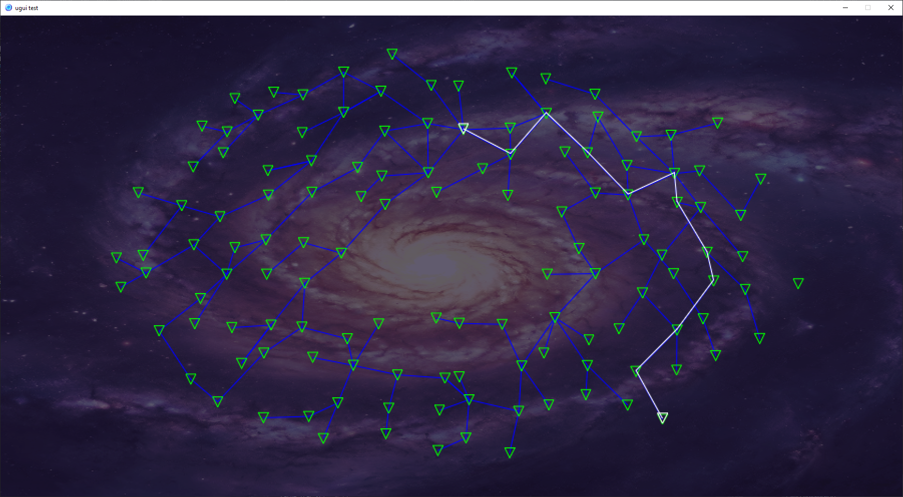
> adding pathfinding
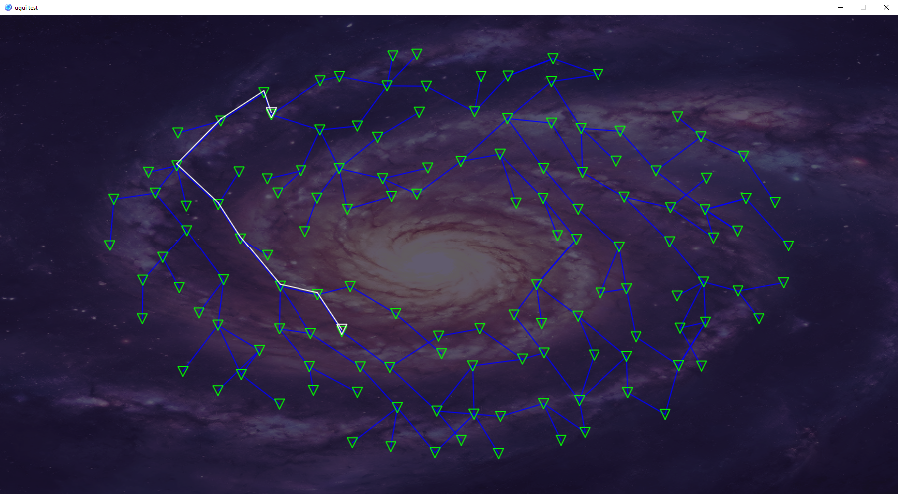
> it works but it's not quite the optimal path, needs a bit more work
> time check, 23 hours in
> October 5, 2023
> Debugging network path finding. Once i get this figured out the plan is to put in pan and zoom, make the locations have icons representative of what is there (planet class, space port, empty space, etc), and allow you to click on a destination and watch the ship make the jumps to get to it

> the original trade wars had an auto-nav system that had different sensitivity levels so that it could auto stop at ports or go straight to the end location (barring interruptions from combat engagements). will probably do something like that
> optimized the pathfinding by switching from depth-first to breadth-first search
> adding in sector details, circle = planet, triangle = port, double triangle = federation station (safe zone), green = lush planet, blue = water planet, yellow = desert planet, red = volcano planet, black = empty space, white = port without planet
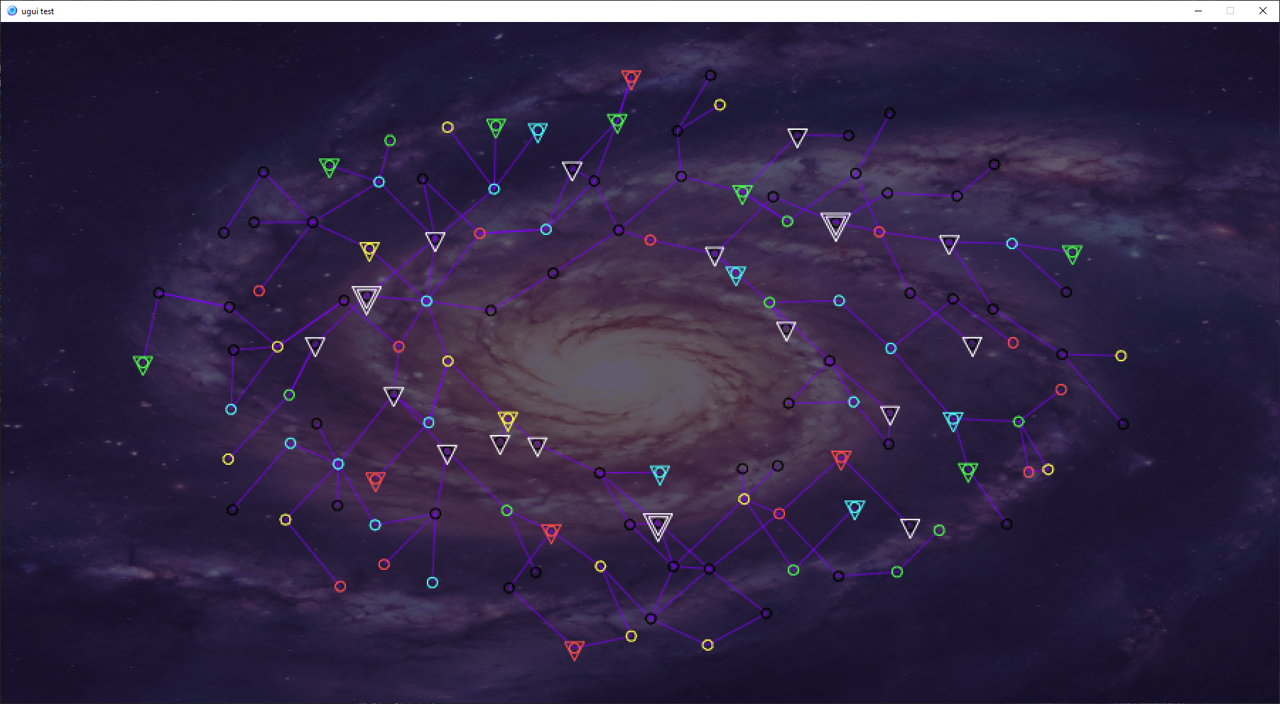
> galaxy map camera zoom and pan in, time check 27 dev hours in so far
[share links]